


-

"Very nice Posters. The quality is amazing and we received it very quickly !"
-

"A shop to visit absolutely. Huge selection of posters. We spent more than an hour there !"
-

"Perfect to find gift. Price are very good. An they can frame and pack it on site"


About the Artist
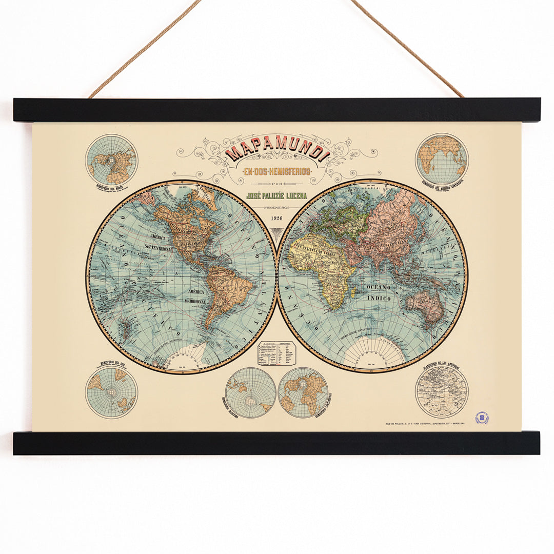
Josep Paluzie Lucena, who lived from 1860 to 1938, was a Spanish mapmaker, illustrator, and editor closely tied to Barcelona's vibrant print culture at the turn of the twentieth century. His career coincided with a period when printed maps became essential tools in education and public life, making geography accessible to a broad audience through schools, atlases, and wall charts.
Paluzie Lucena was instrumental in shaping how people visualized the world, using cartography not only as a scientific discipline but also as a means of fostering curiosity and understanding of global connections. His maps bridged the gap between practical reference and visual storytelling, reflecting the era's fascination with exploration and knowledge.
The Artwork
This Mapamundi was created during a time of rapid global change around 1900, when advances in travel and communication brought distant continents closer together. Intended for classrooms, libraries, and civic spaces, the map served as both an educational resource and a symbol of modernity and ambition.
As a vintage world map poster, it invites viewers to trace coastlines, examine borders, and imagine journeys across oceans. The artwork resonates with the tradition of historic map prints and connects naturally with those who appreciate classic educational art from the early twentieth century.
Style & Characteristics
The map features precise cartographic linework and dense, legible labeling, with latitude and longitude lines providing structure. Crisp, informative typography emphasizes its function as a reference, while decorative flourishes lend it visual appeal as a wall piece.
The color palette combines a warm beige background with cool blue oceans and deeper brown landmasses. Subtle red accents highlight important divisions, creating a clear visual hierarchy. The overall effect is scholarly and quietly adventurous, making it a refined example of antique cartographic art with blue and beige tones.
In Interior Design
This vintage map poster is well suited to studies, home offices, hallways, or living rooms, where its detail can be appreciated up close. It complements traditional, nautical, and eclectic interiors, and brings character to modern spaces seeking a distinctive focal point.
Pair it with natural wood, leather, or brass accents, or echo its palette with textiles in sand, navy, or rust. For a harmonious look, combine it with beige wall art or coordinate with blue tone prints. A simple mat and quality frame enhance its presence as a curated art print in any interior.