


You may also like
-

Africa Map Poster
Rand McNally & Company · 1907 · Vintage print of Africa with finely labeled regions and softly tinted territories
Poster from €9 · Framed from €16
-

South America Map 2 Poster
Rand McNally & Company · 1907 · South America vintage print with labeled countries and routes in a vertical format
Poster from €9 · Framed from €16
-

British Overseas Airways Poster
Seymour E.O. · 1949 · Colorful BOAC world routes poster with sweeping lines across a stylized globe
Poster from €9 · Framed from €16
-

The Floor of the Oceans Poster
Unknown artist · 1967 · Bathymetric world map poster revealing undersea ridges in cool blue tones
Poster from €9 · Framed from €16


-

"Very nice Posters. The quality is amazing and we received it very quickly !"
-

"A shop to visit absolutely. Huge selection of posters. We spent more than an hour there !"
-

"Perfect to find gift. Price are very good. An they can frame and pack it on site"


About the Artist
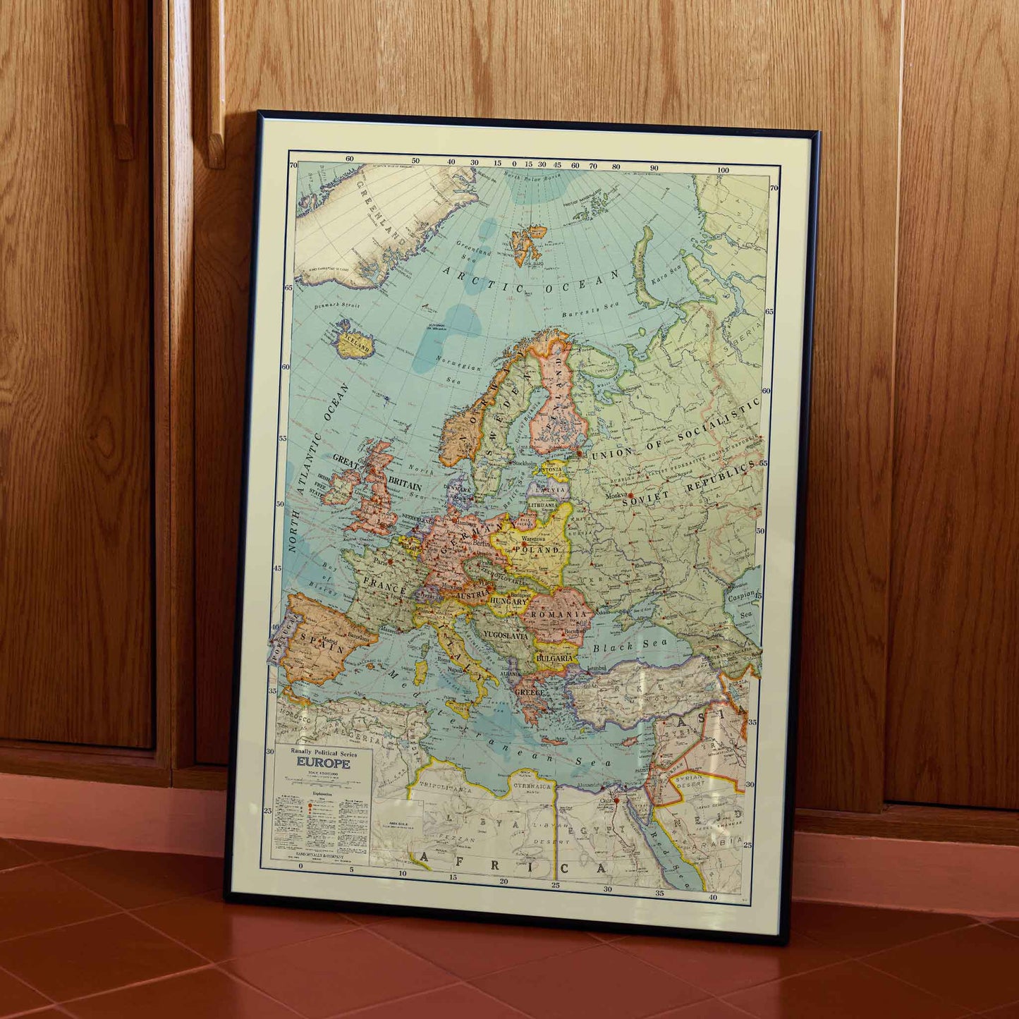
Rand McNally & Company gives this 1931 map a clear place in American cartography. The Chicago publisher built its reputation through practical maps and atlases, and this Political map of Europe carries that purpose into a period of intense change. The firm translated a complicated continent into a reference sheet for classroom use and private study. Today, the map works as a vintage poster and fine art print because it joins documented information with the authority of a period source. For anyone drawn to vintage maps, Rand McNally offers a direct encounter with how European knowledge was organized in 1931.
The Artwork
Seen through the date, the map belongs to a Europe still living with the settlement that followed the First World War. Czechoslovakia and Yugoslavia appear as established states, while the continent remained shaped by agreements that had not yet settled its future. Rand McNally published the sheet as a practical snapshot rather than a prediction. Its purpose was educational, helping readers locate countries within the news. That purpose gives the vintage print a documentary charge today. It records political geography before the next upheaval, allowing this wall art to hold a precise historical question: how stable can a border look when the world around it is changing?
Style & Characteristics
The eye moves from the cream margin into pale blue seas, then settles on central Europe. Green and yellow fields separate territories, while orange and red boundary strokes clarify political divisions. Black lettering varies in scale, letting major names announce themselves before smaller towns reward close reading. Scandinavia forms a tall northern sweep; the Mediterranean opens below with islands and peninsulas. A ruled border encloses the map like an atlas page, and the lower-left legend anchors the vertical poster. Together, these details give the art print the dense information expected from a vintage poster rather than a decorative diagram.
In Interior Design
In a study above a walnut writing desk, the vintage print can govern a quiet wall without making the room feel busy. A slim black frame would repeat the dark lettering and ruled edge, while pale sea areas would open space above the desk. The eye could move from the Atlantic to central Europe during a pause from reading, turning the wall art into a small act of historical attention. Warm wood and a single brass lamp would suit the muted paper tones without competing with the borders. As home decor, this fine art print brings interior decoration toward documentary character: it gives the study a subject to revisit, not merely a surface to fill.